Transportation Maps:
Transit Accessibility for Low-Income Communities: Bus-Stop Proximity Study in Miami-Dade
This map depicts the relationship between areas of high poverty and public transportation accessibility via bus in Miami-Dade County. The primary objective is to identify underserved communities that may benefit from improved bus access to help with transportation challenges for low-income households. This map can also serve as a resource for individuals without cars seeking housing options within accessible bus access. The conclusion of my findings were that additional bus stops and routes would enhance access for people in North Hialeah Gardens, an area of low income and very limited public transit access at a comfortable walking distance standard of .25 miles.
Service Area Analysis of Fire Stations in San Francisco, California
This service area analysis map presents an analysis of areas within San Francisco located within a four-minute driving distance from their designated fire stations. Each fire station is labeled, and the service areas resulting analysis’ polygons are differentiated by a unique color for better clarity and understanding.
For high quality PDFs and downloadable maps click the contact button on the top right and request files.
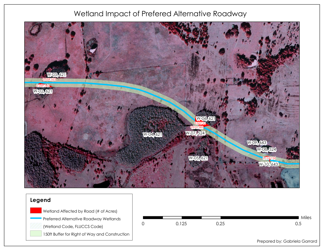
Wetland Impacts of Roadways
This map illustrates the impacts of a proposed roadway construction on a parcel of land containing wetlands. Again, this map uses Color-Infrared (CIR) aerial photography, also known as "false color" imagery, which captures wavelengths beyond normal human perception and eliminates atmospheric interference.. Each wetland area is marked with its unique identification code and corresponding FLUCCS (Florida Land Use, Cover, and Forms Classification System) code. The map also includes labels indicating the acreage of wetland areas affected by the ‘preferred roadway’.